Ragged Islands - KLUMI

Use this section to set the units you would prefer to use when viewing SmartAtlantic data.
Note:
SmartAtlantic data will be converted to use the desired units for
display and charting
purposes only.
Any data obtained via the Data Request feature will continue to use the
units specified in the
dataset.
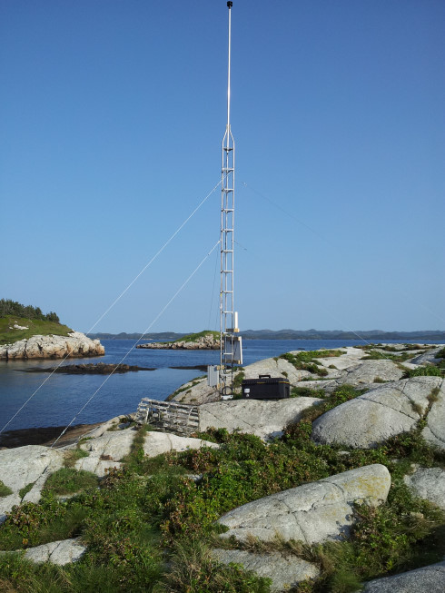
Ragged Islands - KLUMI Station Info
![]()
KLUMI (47.59359 N , 54.27349 W): is a 10 m mast weather station equipped with a Gill ultrasonic wind sensor (WindSonic, option 4). The data are collected via a SUTRON Satlink2-V2 logger connected to an Omni-directional GOES antenna; transmitting near real-time data every hour. 1 min average wind speed and direction as well as gust (maximum) are calculated from the sensor 1 Hz internal sampling rate and recorded by the logger every 10 min. The mast is installed on a barren island, about 10 m height from the mean sea level, located on the northeast side of Placentia Bay. Wind observations are thus made at about 20 m from mean sea level. This weather station is part of a monitoring program led by the Northwest Atlantic Fisheries Centre (Fisheries and Oceans, Canada) to provide with an oceanographic baseline of the area.
Contact: Andry.Ratsimandresy@dfo-mpo.gc.ca